 Skip to content
Visiting the North Rim vs South Rim of the Grand Canyon

Few places in the United States feel as overwhelming in scale as the Grand Canyon National Park. Even after seeing hundreds of photos throughout your life, the first real view of the canyon rarely feels believable. During our road trip from Sacramento to Albuquerque, after leaving Zion National Park, Katie and I made the drive through northern Arizona to experience both the North Rim and South Rim of the canyon during the colder season.
Visiting the Grand Canyon in late October and early winter feels completely different compared to the crowded summer months. Roads are quieter, temperatures are cooler, and the atmosphere feels calmer. The changing weather also gives the canyon a different personality depending on where you stand.
First Stop: The North Rim


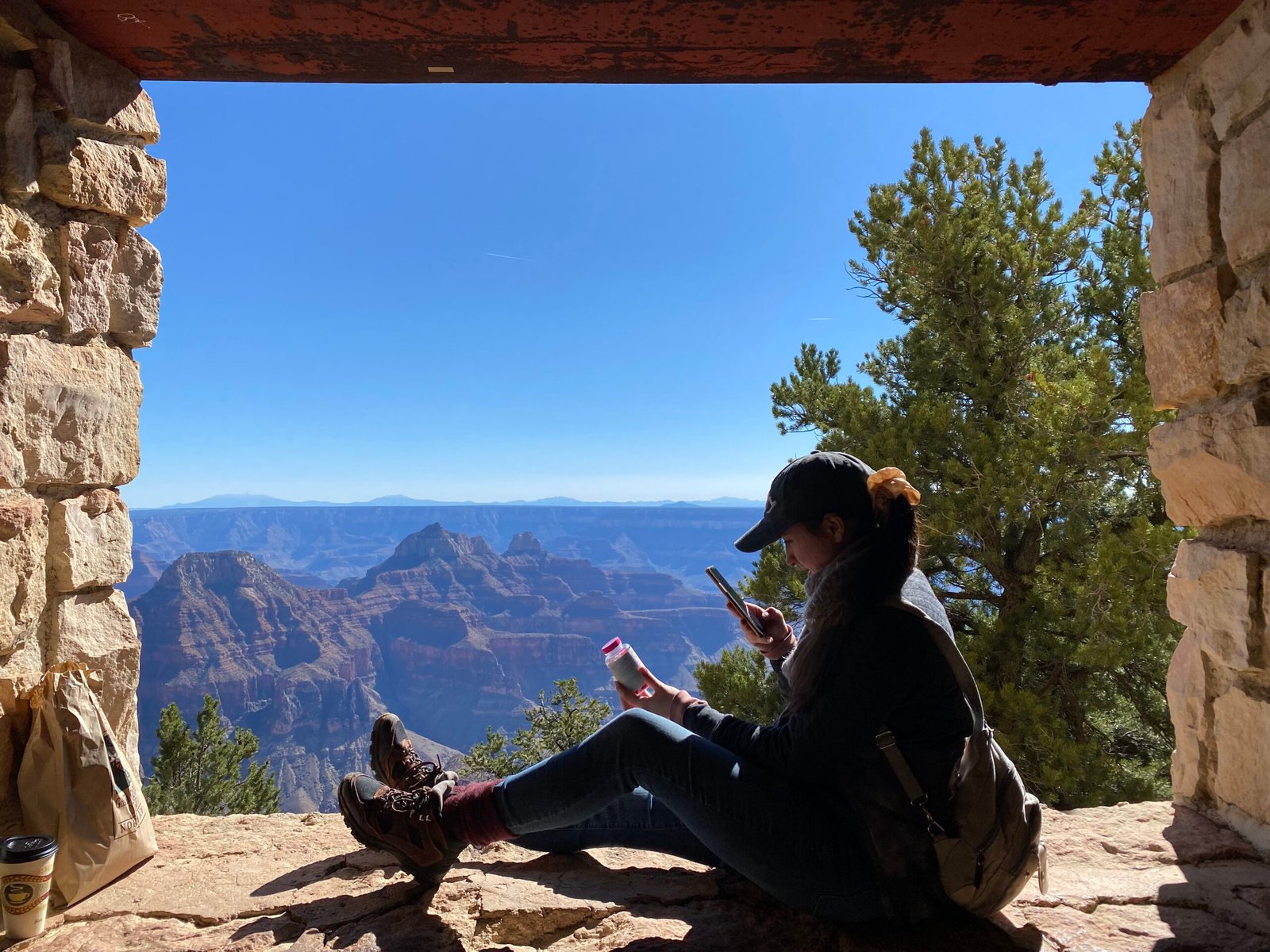
Our first stop was the North Rim, entering through the forests of northern Arizona before arriving at the North Rim Visitor Center. The North Rim sits at roughly 8,000 feet above sea level, over 1,000 feet higher than the South Rim. Because of the elevation, temperatures are much colder, and snowfall often arrives early in the season. The North Rim also receives far fewer visitors each year compared to the South Rim due to its shorter seasonal access and remote location.
The first thing we noticed was how much closer the canyon walls appeared from the North Rim viewpoints. Instead of feeling endlessly wide, the canyon felt more compressed, allowing you to see detailed layers of rock, cliffs, and formations much more clearly. The textures of the canyon walls stood out sharply in the colder weather and lower autumn sunlight.

The Grand Canyon itself was carved primarily by the Colorado River over millions of years, cutting through nearly two billion years of exposed geological history. Many of the visible rock layers in the canyon date back hundreds of millions of years, while some of the deepest exposed rocks near the bottom are among the oldest found anywhere in North America.

The North Rim historically remained less developed than the South Rim because of its isolation and weather conditions. Roads to the North Rim generally close after the first major snowfall, often around mid-to-late October, depending on conditions. That seasonal closure helps preserve a quieter atmosphere that feels more connected to the canyon’s wilderness history.
One of the highlights of the North Rim was seeing the campground area surrounded by pine and spruce forest directly beside one of the largest geological formations in the world. If we ever returned, it would be somewhere we would absolutely stay longer. The contrast between dense forest and the open canyon cliffs is something that makes the North Rim feel unique compared to the desert imagery most people associate with the Grand Canyon.


Driving South Through Arizona
After visiting the North Rim, we continued south toward the South Rim entrance near Grand Canyon Village. Even though both areas belong to the same national park, they feel completely different from each other.
The drive itself shows how massive the Grand Canyon truly is. Despite appearing connected on a map, traveling between the North and South Rim takes several hours by road because there is no direct route across the canyon itself. The canyon stretches approximately 277 river miles long, up to 18 miles wide in some areas, and over a mile deep.
The South Rim has historically been the main tourism center of the park. Railroad tourism began bringing visitors to the canyon in the early 1900s after the arrival of the Grand Canyon Railway. Tourism increased rapidly after the area became protected as Grand Canyon National Park under President Woodrow Wilson.
The South Rim and Yavapai Point

Once we arrived at the South Rim near Yavapai Point, the scale immediately felt different compared to the North Rim. Instead of focusing on nearby rock detail, the South Rim emphasizes distance. The canyon appeared to stretch endlessly toward the horizon, with massive shadows moving across the cliffs as the sun lowered.
We also visited the Yavapai Geology Museum, one of the best places in the park for understanding how the canyon formed. Large panoramic windows overlook the canyon while exhibits explain the visible rock layers and geological timeline. The museum helps put the scale of the canyon into perspective, especially when learning that some of the exposed rock predates complex life on Earth.


The South Rim contains many of the park’s historic buildings and early tourism infrastructure. Much of the village area was developed during the early National Park era, with several structures designed by architect Mary Colter, whose work helped shape the rustic architectural identity of the American Southwest national parks.
From Yavapai Point, we walked part of the Rim Trail, stopping frequently just to look out across the canyon. In winter and late fall, the cooler temperatures make walking much easier than during summer, when temperatures inside the canyon can become dangerously hot. The lower seasonal crowds also make the viewpoints feel far less rushed.

One of the most interesting parts of visiting both rims during the colder season was seeing how the lighting changed the canyon throughout the day. In the morning, parts of the canyon looked soft and blue from shadow. By sunset, the cliffs turned deep orange and red. The canyon never looked the same twice.


Crossing the Ice
One moment from the South Rim that really stood out happened near one of the overlook paths extending closer toward the canyon edge. The path itself was narrow, with one side dropping off along the cliff edge while the other side sloped directly down toward the canyon. During our visit, a section of the trail – probably around five feet long – was completely covered in solid ice.
Katie has much better balance than I do, so she carefully made her way across to see the view farther out over the canyon. I decided to stay behind, which honestly ended up being the smarter choice. As people started coming back across the icy section, several lost their footing trying to cross it. I ended up helping multiple people steady themselves as they made their way back over the ice. Some people crossed it effortlessly, while others nearly wiped out completely. Watching it happen over and over made it surprising that there was not at least some kind of warning sign nearby.
It was one of those reminders that visiting the Grand Canyon National Park in colder months comes with a very different experience compared to summer. The cooler temperatures and smaller crowds are incredible, but ice and snow can quickly turn even short viewpoint trails into something unexpectedly dangerous.
Why Winter Is One of the Best Times to Visit

Most travelers think of summer when planning a Grand Canyon trip, but visiting during late fall or winter has major advantages. Cooler weather makes hiking and walking more comfortable, viewpoints are less crowded, and the atmosphere feels quieter overall.
Winter also creates dramatic contrasts across the canyon. Snow occasionally dusts the rim while the lower canyon remains dry and desert-like. That combination of snow, red rock, and deep canyon shadows creates some of the most visually striking scenery in the park.
Seeing both the North and South Rim on the same trip gave us two completely different perspectives of the Grand Canyon. The North Rim felt closer, quieter, and more rugged, while the South Rim emphasized the sheer scale and endless distance of the canyon itself.
Even after traveling across much of the United States, the Grand Canyon still feels difficult to fully describe in person. Photos rarely capture the true depth, scale, or silence of the canyon. Standing along the rim in the colder months, with fewer crowds and clearer air, made it easier to understand why it remains one of the most important natural landmarks in America.


Leave a Reply